
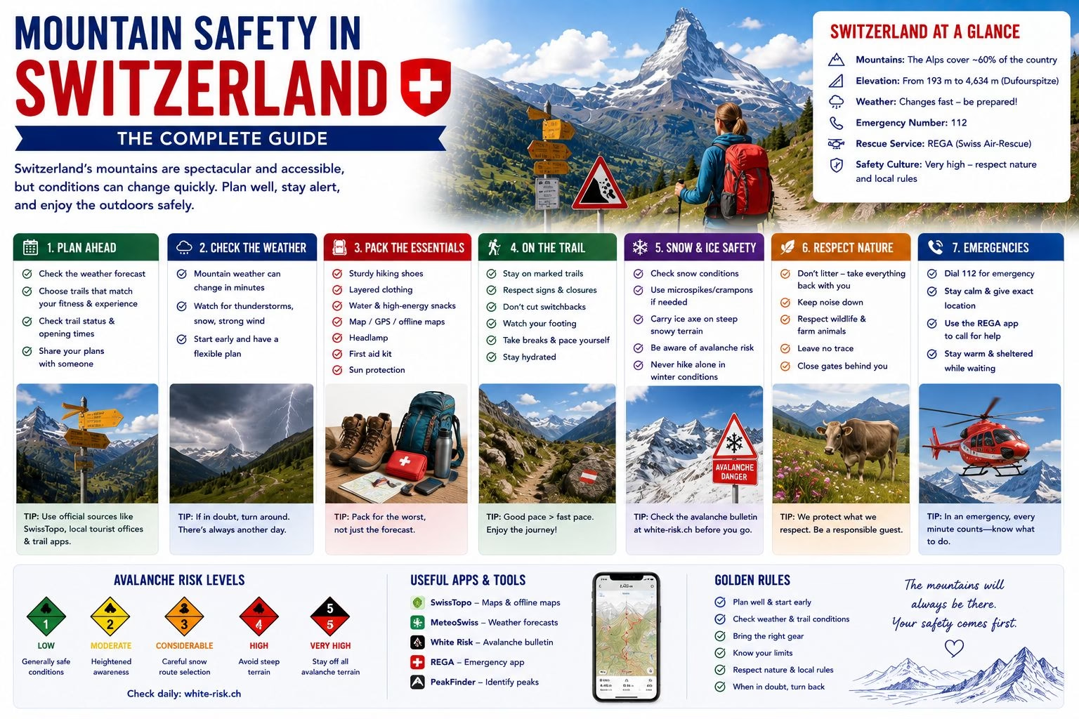
Switzerland’s Alps are extraordinarily accessible and require specific safety awareness. The combination of the mountain railway and cable car infrastructure that brings non-technical tourists to 3,000-metre altitude within an hour, and the genuine risks of Alpine weather, altitude, and terrain, makes mountain safety awareness particularly important in Switzerland. This guide covers the key practices for safe mountain activity.
Understanding the Trail Rating System
Swiss hiking trails are graded in three categories (see the full hiking guide for details). For safety purposes, the critical distinction:
Yellow trails (Wanderwege): No specialist skills or equipment required; appropriate for any reasonably fit person in standard walking shoes.
White-red-white trails (Bergwege): Require sure-footedness, appropriate footwear (hiking boots with grip and ankle support), and the ability to handle exposed sections on narrow paths. These trails are NOT appropriate for sandals, flip-flops, or standard trainers in wet conditions.
White-blue-white trails (Alpinwege): Require technical Alpine experience; helmets, crampons, and rope may be required depending on conditions. Not appropriate for recreational hikers without specific Alpine training.
Misreading a trail grade and attempting a Bergweg in inappropriate footwear or weather conditions is the most common cause of mountain emergencies in Switzerland involving tourists.
Alpine Weather: The Most Unpredictable Risk
Alpine weather changes faster than most visitors expect. The mechanism: warm moist air rises along valley sides, cools, and forms cumulonimbus clouds that can produce thunderstorms within 30 to 60 minutes of appearing as small cumulus clouds. A morning that is clear and sunny can produce a dangerous thunderstorm by 2pm.
The specific rules:
- Start hikes early (before 8am for demanding routes) to complete exposed sections before afternoon weather deteriorates.
- Watch the clouds actively. Clouds building in the west and southwest are the standard warning of incoming weather in Switzerland.
- If caught in a thunderstorm on an exposed ridge: descend immediately by the fastest available route, whether the planned route or a direct descent to the valley; do not shelter under isolated trees; remove metal (poles, ice axes) and place them away from your body; crouch low with feet together if lightning is striking nearby.
The MeteoSwiss app (Switzerland’s official meteorological service, free, available in German, French, and Italian) provides the most accurate mountain-specific weather forecasts, including summit-specific temperature, wind, and thunderstorm probability.
The Emergency Services: Rega
Switzerland’s mountain rescue service is operated by Rega (Schweizerische Rettungsflugwacht, Garde Aérienne Suisse de Sauvetage). The Rega helicopter rescue operates throughout Switzerland and is the primary emergency response for mountain accidents.
Emergency number: 1414 (Rega) or 112 (general European emergency).
The Rega app allows GPS position sharing directly with the rescue service when calling for help; this dramatically reduces rescue response time in areas without visible landmarks or addresses.
Rega operates as a non-profit cooperative; an annual donation of CHF 30 per adult (CHF 50 per family) provides rescue coverage for Swiss residents and reduces costs for non-members. Foreign visitors are covered by their travel insurance for Rega costs; ensure travel insurance specifically covers mountain rescue and helicopter evacuation, as the costs are significant without coverage.
Altitude Awareness
Switzerland’s cable cars and mountain railways can bring visitors from sea level to 3,000+ metres within a few hours. Most healthy visitors experience no significant symptoms at these altitudes; some experience mild headache, fatigue, or shortness of breath. Actual altitude sickness (requiring descent and medical treatment) is uncommon below 3,500 metres for healthy visitors.
Practical precautions at high altitude:
- Drink extra water; dehydration exacerbates altitude effects.
- Avoid significant physical exertion in the first hour at altitude; walk slowly on ascent.
- Descend if symptoms worsen rather than improve with rest.
The specific risk of the Klein Matterhorn (3,883 metres) and the Jungfraujoch (3,454 metres): visitors with cardiovascular conditions, respiratory issues, or who have not been at any significant altitude recently should discuss these excursions with a physician before booking.
Equipment for Day Hikes
The minimum safety equipment for any hike above the Yellow trail grade in Switzerland:
- Hiking boots with ankle support and grip: not optional for wet or rough terrain.
- Rain jacket: the Alps can produce full rain within an hour; being wet at altitude in strong wind produces dangerous cooling.
- Extra warm layer: temperature can drop 10 to 15 degrees Celsius in an afternoon storm.
- Headtorch: in case of emergency delay extending into dark.
- Charged mobile phone: with the MeteoSwiss and Rega apps downloaded; plus emergency numbers saved.
- Water: 1 litre minimum; refill at streams on longer routes.
- Trail map or offline navigation: the Swisstopo app provides the official Swiss topo maps offline.
Related: Hiking in Switzerland | Mountain Weather Checklist | Packing Guide | Plan Your Trip
Written by Laura Meier. Updated regularly as prices and conditions change. Corrections and updates are welcome at contact@allaboutswiss.com.