
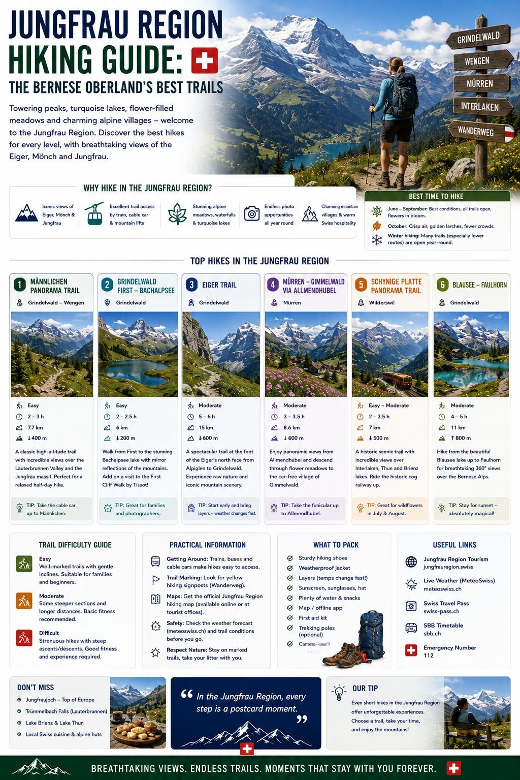
The Jungfrau region, centred on the triangle of peaks formed by the Eiger (3,967 metres), Mönch (4,107 metres), and Jungfrau (4,158 metres), contains hundreds of kilometres of marked hiking trails from the valley floors at 1,000 metres to the high Alpine terrain approaching 3,000 metres. It is the most visited hiking area in Switzerland for good reason: the infrastructure, the scenery, and the trail quality combine to produce an experience that is accessible to visitors with limited Alpine hiking experience while offering sufficient variety for those who return repeatedly.
Base Villages for Jungfrau Region Hiking
Grindelwald (1,034 metres): The most accessible base, with direct trains from Interlaken (40 minutes) and access to both the Eiger side (First gondola, Männlichen cable car) and the Jungfraujoch railway via Kleine Scheidegg. Best for: first-time visitors who want flexibility and a good range of accommodation; those combining hiking with the Jungfraujoch summit excursion.
Wengen (1,274 metres): Car-free village on the western side of the valley, accessible by rack railway from Lauterbrunnen. Quieter than Grindelwald; good for families and those who want the car-free mountain village experience. Best for: the Männlichen ridge walk, the Wengernalp route, and the Jungfraujoch access via the Wengernalpbahn.
Mürren (1,638 metres): The highest of the three main base villages, perched on the cliff above the Lauterbrunnen valley. Car-free, accessible only by cable car from Stechelberg or by the cable car from Lauterbrunnen to Grütschalp and then the narrow-gauge railway to Mürren. Best for: the Panoramaweg, the Schilthorn access, and the experience of Switzerland’s most dramatically situated mountain village.
The Key Routes
The Bachalpsee Walk (from First, Grindelwald): The most popular walk in the Bernese Oberland and deservedly so. The gondola from central Grindelwald to First (2,168 metres) takes 25 minutes; from First, a wide, well-maintained path climbs gently for approximately 1 hour to the Bachalpsee lake at 2,265 metres. The lake surface on a clear morning reflects the Schreckhorn and Finsteraarhorn. The return takes 45 minutes. Grading: easy, on a well-maintained path; comfortable trail shoes are enough. Time: about 2 hours round trip from First, or around 3 with stops.
The Männlichen to Kleine Scheidegg Ridge Walk: One of the best views in the Bernese Oberland. The Männlichen cable car from Grindelwald Grund (or the Luftseilbahn Wengen-Männlichen from Wengen) reaches the Männlichen ridge at 2,230 metres. The Panorama Trail to Kleine Scheidegg is about 4.5 kilometres and mostly downhill, following the ridge with the Eiger, Mönch, and Jungfrau directly ahead and the Grindelwald and Lauterbrunnen valleys below on both sides. Time: 1 to 1.5 hours. Grading: yellow (easy). This walk is suitable for visitors without hiking experience if they take the cable car; the descent to Wengen or Grindelwald requires trail shoes and some fitness.
The Panoramaweg, Mürren (Mürren to Grütschalp): The classic Mürren route. From the village, a maintained path runs west along the cliff edge above the Lauterbrunnen valley toward Grütschalp, the lower cable car station. The views across the valley to the Jungfrau, Mönch, and Eiger are among the finest in the region; the route stays at approximately 1,600 metres with minimal ascent. Time: roughly 1.5 hours one way. The narrow-gauge railway between Mürren and Grütschalp runs back to the village, and a cable car links Grütschalp with Lauterbrunnen. Grading: yellow, suitable for all fitness levels.
The Pfingstegg to Baregg Circuit: A less-visited Grindelwald route. The Pfingstegg cable car (10 minutes from the Grindelwald centre) reaches 1,391 metres; trails from there ascend toward the Baregg moraine with views of the Upper and Lower Grindelwald glaciers. The route involves some steeper sections; appropriate for fit walkers with trail shoes. Time: 3 to 4 hours for the circuit. Grading: white-red-white.
The Jungfraujoch: Summit Without Climbing
The Jungfraujoch railway station (3,454 metres) is not a hiking destination but a starting point for high-altitude experiences. The Sphinx Observatory terrace (3,571 metres) provides the panorama of the Aletsch Glacier and the four-thousand-metre summits. Walking on the glacier from the summit is possible in summer under safe conditions; the Monk’s hut (Mönchsjochhütte, 3,657 metres) is accessible by a 2-hour glacier walk with appropriate equipment.
Seasonal Considerations
The main hiking season in the Jungfrau region runs from late June to mid-October. Below 1,500 metres, trails may be open from May; above 2,000 metres, snow may persist until July in heavy snow years. The Bachalpsee walk, the Panoramaweg, and the Männlichen ridge walk are typically open from mid-June.
September is the recommended peak month: summer crowds have reduced after the Swiss school holidays end, trail conditions are generally excellent (dry trails and little snow at most accessible altitudes), and the light is extraordinary for photography.
Getting There
Interlaken is the valley hub for the whole region, reached directly from Zürich (around 2 hours) or Bern (50 minutes) by train, with Interlaken Ost station the departure point for the branch lines into Grindelwald, Lauterbrunnen, and onward to Wengen and Mürren. None of the three base villages require a car, and Wengen and Mürren don’t allow one at all; the whole region is designed around its rail and cable car network rather than road access, which is part of what makes it so approachable for visitors without Alpine hiking experience.
Related: Hiking in Switzerland | Bernese Oberland Hiking | Zermatt Hiking | Grindelwald Skiing | Mountain Safety
Written by Laura Meier. Updated regularly as prices and conditions change; corrections and updates welcome at contact@allaboutswiss.com.