
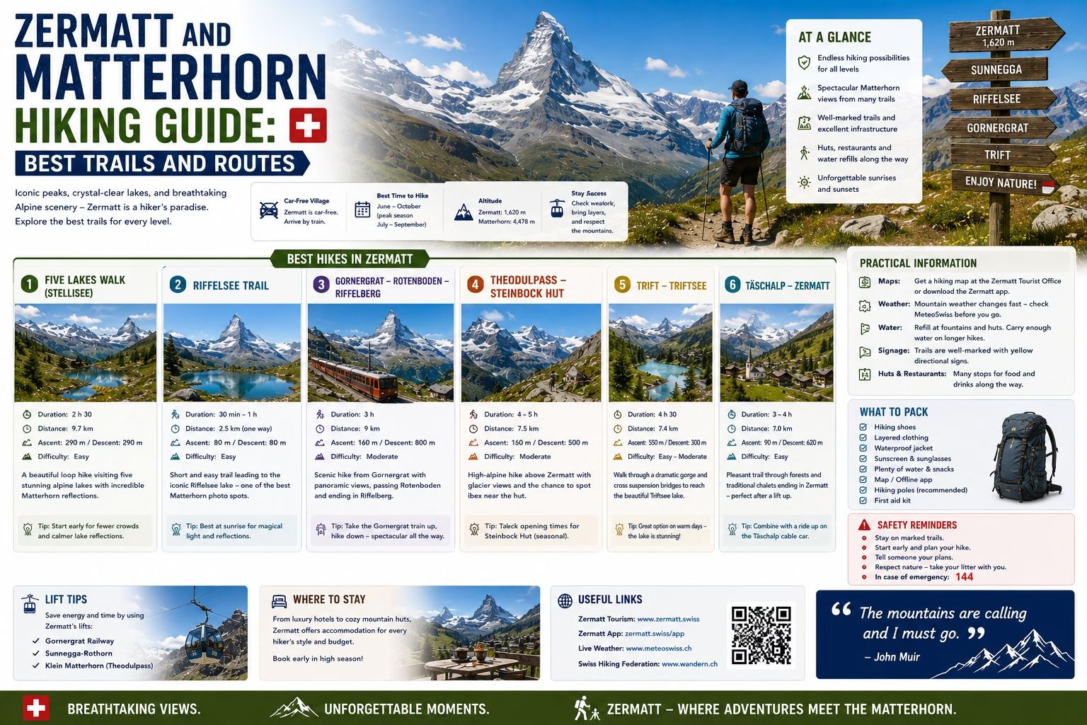
The hiking terrain around Zermatt is the most spectacular in Switzerland. The concentration of 4,000-metre peaks (the Gornergrat panorama alone takes in 29 of the 82 peaks above 4,000 metres in the Alps), the glaciers descending from the high peaks, and the specific quality of the Valais light at altitude produce a hiking experience that is qualitatively different from the Bernese Oberland: more austere, more exposed, and more rewarding at the higher elevations. This guide covers the main trails and the logistics of using them.
The Trail Infrastructure
Zermatt’s hiking infrastructure operates in three altitude zones:
Valley zone (1,600 to 2,000 metres): Easy trails along the valley floor and through the forest above the village. The Täschgufer walk (south toward Täsch), the trail along the Zmuttbach stream, and the forest paths above the village are appropriate for visitors acclimatising or those who do not want cable car access.
Middle zone (2,000 to 2,800 metres): The most rewarding hiking terrain for most visitors, accessible by cable car from Zermatt to the Sunnegga, Blauherd, or Furi stations. This zone contains the lake circuits, the ridge walks, and the highest-quality views from accessible terrain.
High zone (above 2,800 metres): Requires either the Klein Matterhorn cable car system for access or full-day ascents from the middle zone. The terrain at this level is glacial and requires appropriate equipment for anything beyond the maintained observation areas at cable car stations.
The Key Routes
The Five Lakes Walk (Fünf-Seen-Wanderung): The most celebrated hiking route in the Zermatt area. Starting from the Sunnegga cable car station (2,288 metres, accessible by underground funicular from Zermatt in 4 minutes), the route connects five high-altitude lakes: Stellisee, Grindjisee, Grünsee, Moosjisee, and Leisee. Each lake reflects the Matterhorn under the right conditions; the Stellisee reflection is the most photographed. The circuit is about 9.5 kilometres and takes 3 to 4 hours at a relaxed pace. Requires appropriate footwear but no technical ability.
The Schwarzsee Circuit (Schwarzsee lake at 2,583 metres): The cable car from Zermatt via Furi to Schwarzsee (approximately 30 minutes) reaches the lake beneath the Matterhorn’s north face. The circuit around the lake (1 hour) and the longer extension toward the Höhbalmen (additional 1 to 1.5 hours, steeper and more demanding) provide the closest views of the Matterhorn available without technical mountaineering. Best in the early morning before the clouds build. Grading: white-red-white (Schwarzsee circuit easy; Höhbalmen extension more demanding).
The Gorner Glacier View Route: The Rotenboden station (accessible via the Gornergrat rack railway) provides a platform above the Gorner Glacier, the second-largest glacier in the Alps. The walk from Rotenboden to Riffelalp (approximately 2 hours, descending) follows the glacier edge with changing perspectives on the Matterhorn and the Monte Rosa massif. Grading: white-red-white.
The Gornergrat Summit (3,089 metres): The Gornergrat rack railway from Zermatt station (about 33 minutes, with a 50 percent discount for Swiss Travel Pass holders) reaches one of the highest rack railway stations in the world. The panorama from the summit encompasses 29 four-thousand-metre peaks and the full extent of the Gorner Glacier. This is not a hiking route but a viewpoint; it is the single best panorama accessible by public transport in Switzerland.
Altitude Acclimatisation
Zermatt sits at 1,608 metres. Visitors arriving from sea level or from the Swiss lowland cities typically feel no altitude effects at the village level. However, rapid ascents to the Klein Matterhorn at 3,883 metres or the Gornergrat at 3,089 metres can produce mild altitude symptoms (headache, shortness of breath, fatigue) in visitors not acclimatised to altitude.
Practical precautions: drink extra water; avoid heavy alcohol consumption on the first day; if planning the Klein Matterhorn visit, consider spending a day at lower altitude first; descend immediately if symptoms worsen rather than improve with rest.
Getting Around: The Cable Car System
Zermatt has three separate mountain access systems (Sunnegga, Matterhorn Glacier Paradise/Klein Matterhorn, and Gornergrat) that are not directly connected at altitude. Moving between them requires returning to the village level or making long hiking connections between the systems. Plan daily excursions around one system rather than trying to use multiple systems in a single day. Day passes for each system are available; the Swiss Travel Pass provides the Gornergrat railway at a 50 percent discount and covers the base-level connections.
Getting There: A Car-Free Village
Zermatt is one of the only car-free resort villages in the Alps, and reaching it reflects that: visitors drive to Täsch, the last village with road access, and complete the 12-minute journey into Zermatt by a dedicated shuttle train that runs about every 20 minutes. Parking at Täsch is paid and generally straightforward outside the very busiest weeks. From further afield, Zermatt connects by train from Visp on the main Valais line, itself reachable from Geneva, Bern, or Zürich, making the full journey from a major Swiss city typically 3 to 4 hours door to door.
Related: Hiking in Switzerland | Winter Skiing: Zermatt | Mountain Safety | Plan Your Trip
Written by Laura Meier. Updated regularly as prices and conditions change; corrections and updates welcome at contact@allaboutswiss.com.